About the Holy Island Causeway
Everything you need to know to cross safely
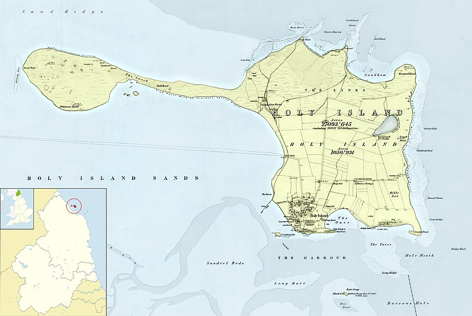
Where is the Causeway?
Holy Island sits just off the Northumberland coast, around 20 minutes from the A1.
It's connected to the mainland by a 3-mile tidal road, known as the causeway.
- At low tide, it looks like a normal road
- At high tide, it disappears completely beneath the North Sea
Why the Causeway Floods
The sea rises several metres during high tide, covering large sections of the road.
Tides are caused primarily by the moon, but also the sun's gravitational pull, which means:
- There are two high tides per day
- They occur at different times each day
- The height varies depending on the relative position of the sun and the moon
At high tide, the island becomes completely cut off.
Does the Weather Affect It?
During strong winds and storms, there's a storm surge effect which can:
- Increase water levels beyond predicted tidal heights
- Create larger waves that wash further onto the causeway
- Make the road unsafe even when it should be technically safe
When Is It Safe to Cross?
You should only cross during the official safe crossing times.
As these are tidal they are calculated years in advance.
The road becomes unsafe around 2 hours before high tide
It may remain unsafe up to 3 hours after
But don't rely on rough estimates, always check the crossing times.
Why Cars Get Stranded
Between 10 and 20 rescues are needed by the RNLI each year, and its usually for the same reasons:
1. Leaving too late
Drivers think it still looks fine and start crossing after the safe window.
2. Underestimating water depth
Even shallow-looking water can:
- Flood the engine
- Cause total engine failure
- Leave the car stranded within minutes
3. Trying to push through
Once water is ahead and behind, there's no safe way out.
If this happens, the only option is often to abandon the vehicle and wait for rescue.
4. Not reading the signs
Some people simply don't know the risks or don't read the warning signs at the causeway entrance.
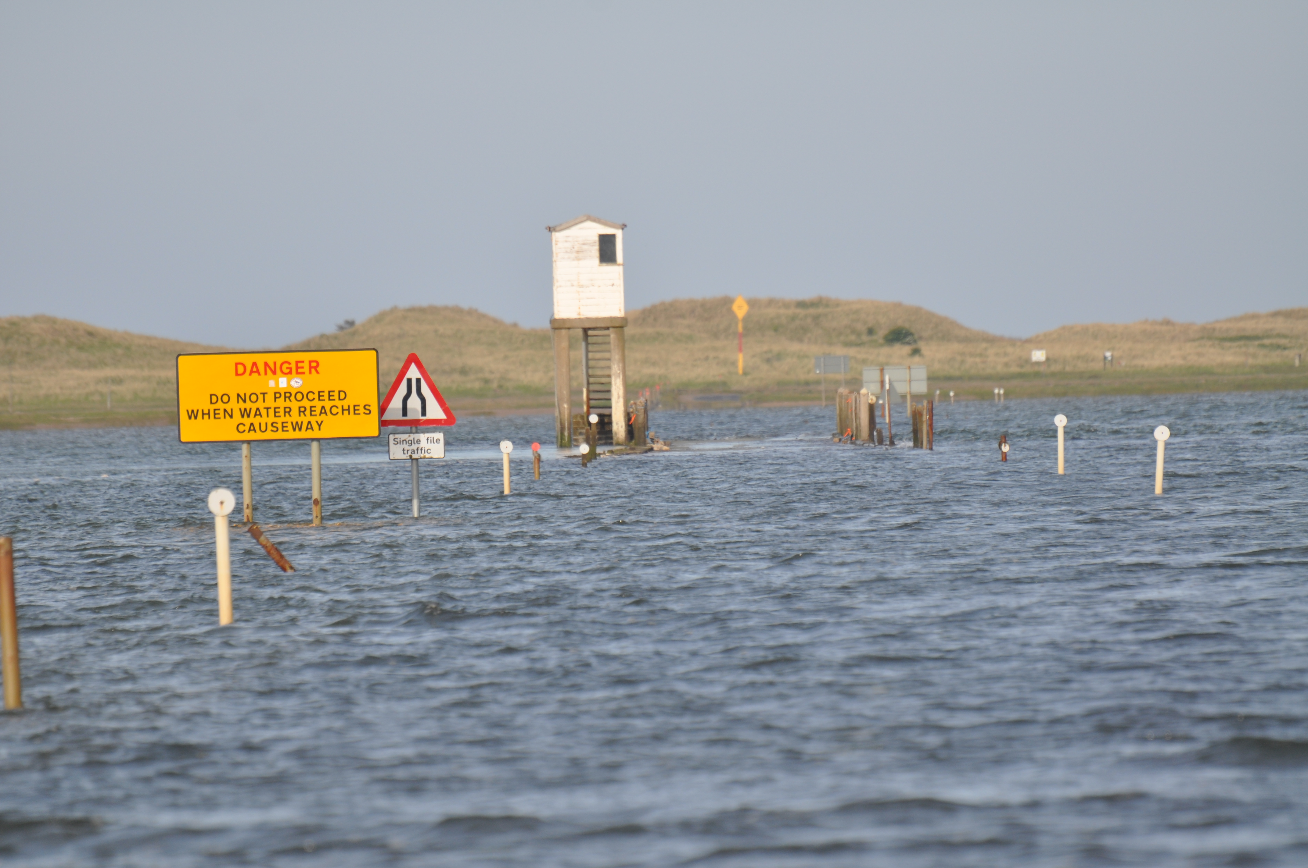
The Refuge Hut ("Idiot Box")
At the mainland end of the causeway, you'll see a raised refuge shelter.
This is there for emergencies only, when people are caught by the tide and need to get out of their vehicle.
Get out of the car early
Move to the refuge
Call 999 and ask for the Coastguard
How to Stay Safe
It's simple:
- Only cross during official safe times
- If in doubt, don't go
- If water is already on the road, turn back immediately
- Allow extra time in bad weather
Hundreds of thousands of people visit safely every year, problems only happen when people ignore the rules.
Important Tips
- The causeway is shared with pedestrians and cyclists so please drive carefully
- Water can hide potholes and debris
- There are no dedicated walkways
- The speed limit is 60 mph, but adjust for conditions
Walking vs Driving
There are two completely different ways to reach Holy Island:
1. The Causeway (Driving or Cycling)
- This is the road crossing
- The times shown on this site apply to this route only
- Used by cars, cyclists, and some walkers
2. The Pilgrim's Way (Walking Only)
- A historic walking route across the sands
- Marked by wooden poles
- Not the same as the road
The safe crossing times for the causeway do NOT apply to walking routes.
Walking the Pilgrim's Way requires:
- Different timing
- Local knowledge
- Awareness of fast-moving tides and shifting sands
If you plan to walk, you must follow separate guidance specifically for that route.
Walking Guide: How to Walk the Pilgrim's Way to Holy Island
More About the Island
Check out this amazing Instagram reel by Geordie Hiker:
A Final Note
The causeway is part of what makes Holy Island special.
Plan ahead, respect the tide, and you'll experience one of the most memorable crossings in the UK.